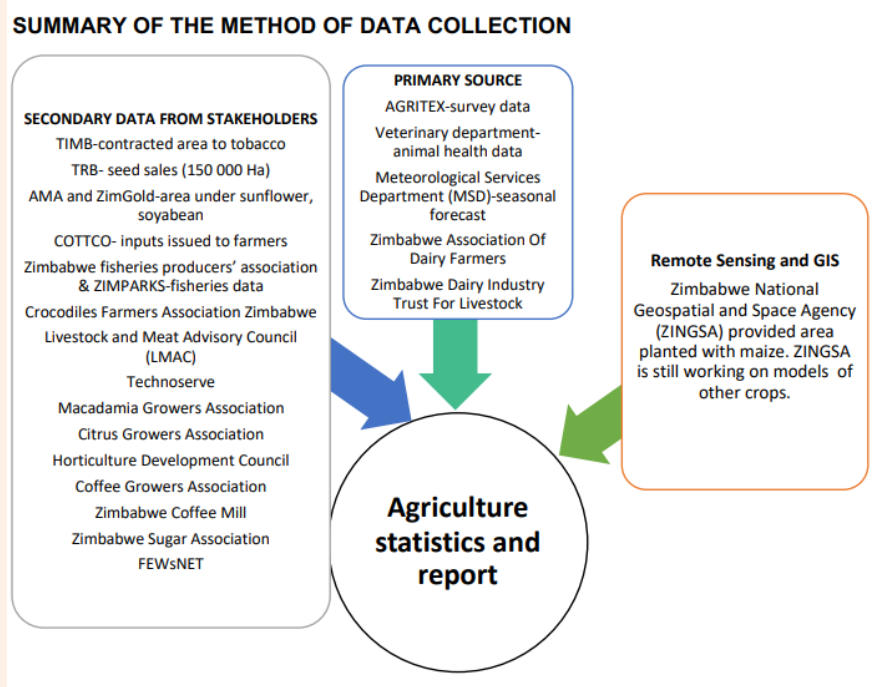
How do they even gather this data?
The report uses data from various sources. These include surveys from government departments such as Agritex, and from farmers’ associations. Some 58 000 farmers were interviewed. On maize, the report used data from the Zimbabwe National Geospatial and Space Agency (ZINGSA), which uses satellite data to measure the planted area.
– NewZWire
(596 VIEWS)
Finance Minister Mthuli Ncune was yesterday taken to task over the cost of the Trabablas…
Plot holders from Irene Township in Mutasa District just outside Mutare, who are being evicted…
An 87-year-old plot holder at Irene Farm in Mutasa District has been ordered to vacate…
A British legislator who has been a strong critic of Zimbabwe has asked the United…
Britain is still against Zimbabwe’s rejoining of the Commonwealth arguing that Harare needs to take…
Zimbabwe, which aims to become an upper middle income country in five years, is one…